
Three field-tested moves: a whistle-map reset, a shoelace distance bead, and a phone-in-a-bag navigation routine.
Hang your whistle on the map lanyard, not your pack
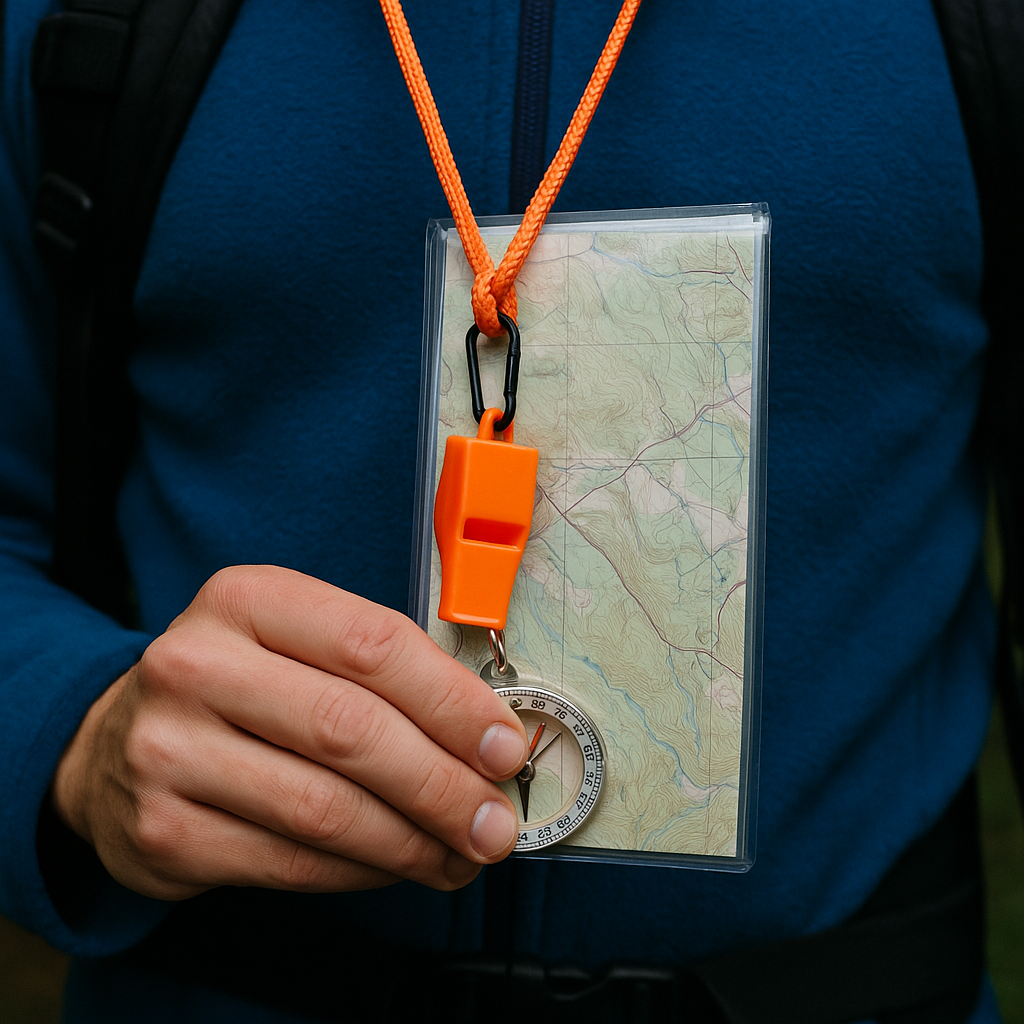
I used to keep my whistle clipped to a shoulder strap because that is what every gear photo shows. Then I watched how I behave when the trail turns into a choose-your-own-adventure: I stop, I pull out a folded paper map (or a Gaia GPS screenshot), and I stare at it like it is going to apologize. The whistle was technically on me, but it was never part of the moment where decisions happen. Now I run the whistle on the same lanyard as my compass and map. It is not for drama. It is a physical "stop" sign that shows up in the same handful of seconds when you are tempted to keep wandering.
Here's how it plays out. I hit a weird junction, no clear blaze, and I can feel the group drifting forward because forward feels productive. I take the lanyard in hand, and that is the cue: whistle in the fist, map open, compass out. Nobody moves while the whistle is in my hand. It is a tiny rule, but it prevents that slow-motion split where one person goes 30 yards, another follows, and suddenly you are yelling names through the trees. The whistle is also what I use to pull everyone back in without sounding panicked. Three short blasts is the universal distress signal, so I do not use that. I use one sharp blast to mean "freeze" and two to mean "come back to me". We agree on it at the trailhead, and then I hardly ever need it.
The hands-on part: put a small carabiner or split ring on the map lanyard and clip the whistle there, not dangling from your chest where it bounces. I like the flat Fox 40 style because it does not fill with grit. If you carry a paper topo in a zip bag, punch a hole in the bag's corner and run the lanyard through so the whistle, compass, and map are one unit. When I'm tired, I am not going to remember three separate systems. One bundle is the point.
Make a shoelace distance bead for the mile you always underestimate
There is a certain kind of trail confusion that has nothing to do with bearings or declination. It is the "we've been hiking forever" feeling, which makes people push for a shortcut, a bailout, or a mystery spur that "has to" connect back. When that mood hits, I don't fight it with pep talks. I give the hike something physical to count.
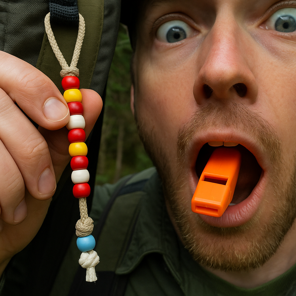
I keep a short piece of old shoelace in my map case with ten cheap pony beads. Before the hike, I check the map scale and pick a simple unit that matches the route: half-mile beads if it's a rolling trail with lots of junctions, one-mile beads if it is a long out-and-back. Then I tie the shoelace to my pack strap or belt loop where I can reach it without stopping. Each time my watch, phone, or printed map says we've hit another unit, I slide one bead down.
It sounds almost too basic, but in the field it is weirdly calming. You can be in a dense stand of firs with no view, the tread can feel like it is looping, and the bead count still moves forward. It also makes "are we there yet" conversations shorter because you can answer with a number that is not a guess: "Two beads left to the creek crossing." If you are using a GPX track, you can still do it. Most apps show distance traveled even when the arrow jitters. I do not care if it says 4.92 or 5.08. I care that the fifth bead moved and we are not going to invent a shortcut out of boredom.
The practical details I learned the annoying way: do not use slick paracord, the beads slide too easily and you will bump them by accident while grabbing a snack. A cotton shoelace has enough friction. Tie a fat knot at the bottom so you cannot lose the whole string when your gloves are on. And if you are hiking with someone who likes the "one more ridge" optimism, hand them bead duty. It gives them something to do besides negotiate.
The phone-in-a-freezer-bag navigation routine
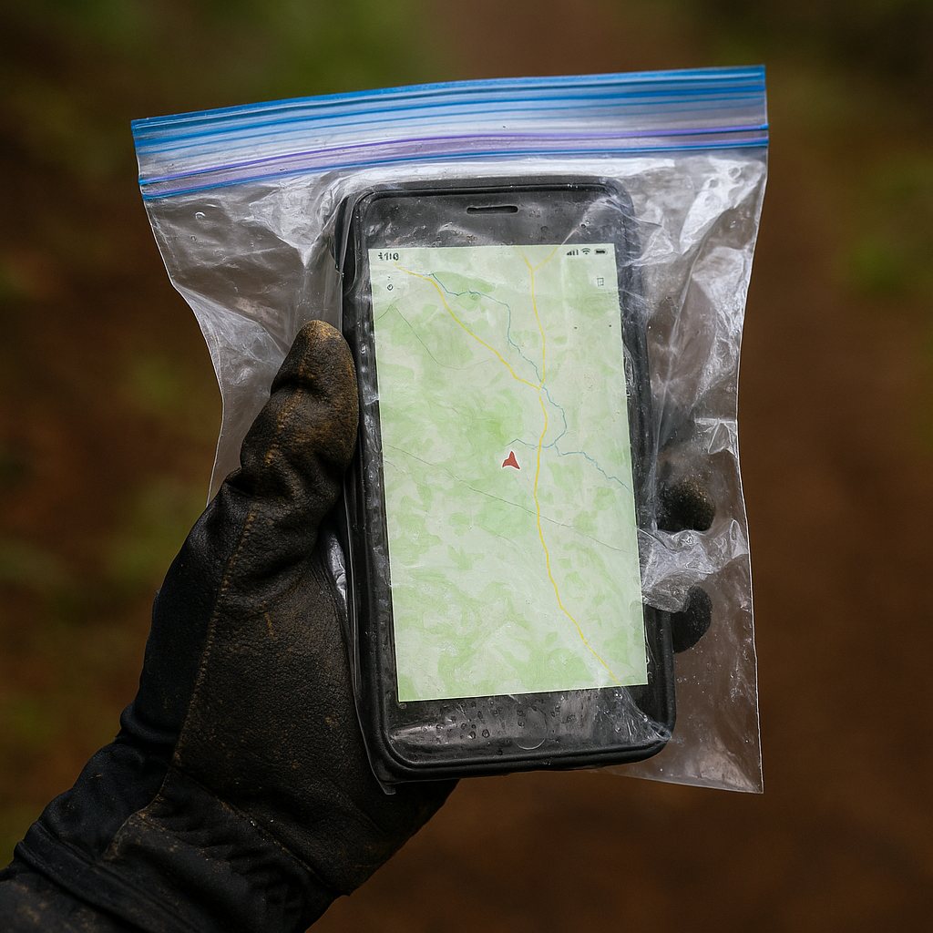
I love a good GPX track. I also hate how quickly a phone turns into a liability when the weather gets sharp. Cold hands, drizzle, and a touch screen makes people do this little dance where they keep pulling the phone out, squinting, and then stuffing it back in because they're afraid of dropping it. After watching that spiral a few times, I started carrying a plain gallon freezer bag and treating it like part of my navigation kit, right alongside the compass.
The routine is simple and consistent, which is the whole point. Phone goes in the bag before we even leave the trailhead. Screen brightness gets set once, and then I stop fiddling. If I'm using Gaia GPS, CalTopo, or AllTrails, I load the offline map tiles in advance and switch the phone to airplane mode. On trail, I only check the map at predetermined moments: big junctions, obvious terrain changes (a saddle, a creek crossing, the top of a long climb), and any time the tread quality changes in a way that makes my shoulders tense. Otherwise it stays put.
The freezer bag does three practical things. First, it lets you use the phone in the rain without smearing everything into a foggy mess. Second, it buys grip. A slick phone case with wet gloves is how phones die. Third, it keeps trail grit out of your charging port. That sounds minor until you are back in the car trying to charge and the cable will not seat because you packed half the ridge into the port.
I still carry a paper map because batteries and screens are fragile, but the bag routine makes the phone usable instead of precious. If you want one extra improvement, put a small loop of duct tape on the bag's corner as a pull tab. Cold hands can open a freezer bag, but not gracefully, and you will not want to wrestle with it while standing on a windy switchback staring at three possible lines through the trees.